| layout | post |
|---|---|
| title | Weather |
| published | true |
| image | PribicevicU_PALiSADES_LAMBOBurning.PNG |
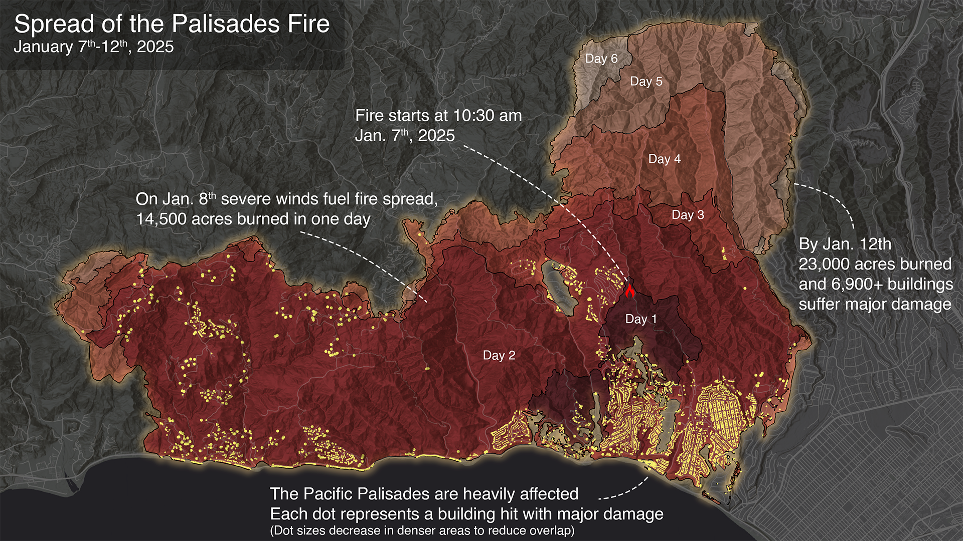
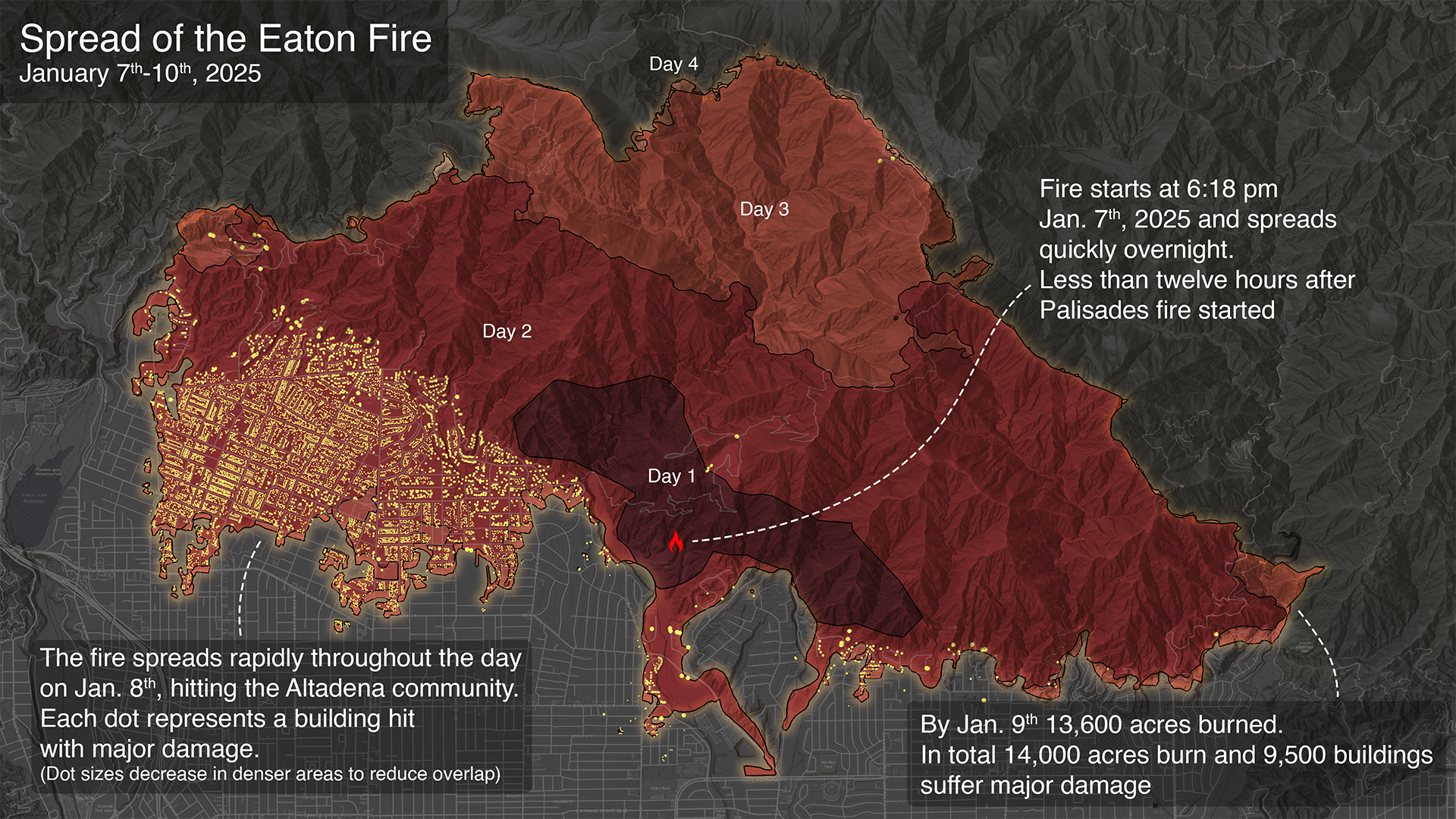
Overview Maps of 2025 Los Angeles Fires

On January 7th, 2025, a series of wildfires started in the Southern California area, heavily affecting Los Angeles communities. The fires spread rapidly due to an abnormally dry year coupled with extreme winds raging at up to 100 miles per hour. Two of the fires, Eaton and Palisades, affected densely populated neighborhoods, spreading rapidly from structure to structure and combining to cause severe damage to over 16,000 homes and businesses. Released Friday, July 11, 2025
@stateofcalifornia @cityoflosangeles @nasa @dhs-gov
Wildfires in Los Angeles, California Image captured on Jan 8, 2025 ECOSTRESS Data Incorporated Into New Wildfire Response Tool